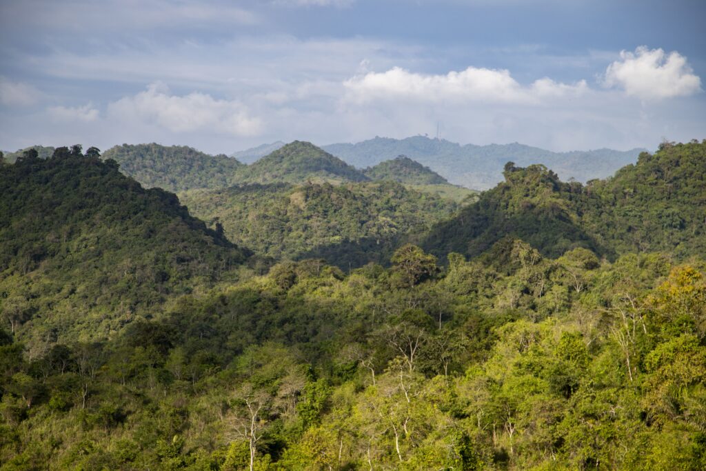
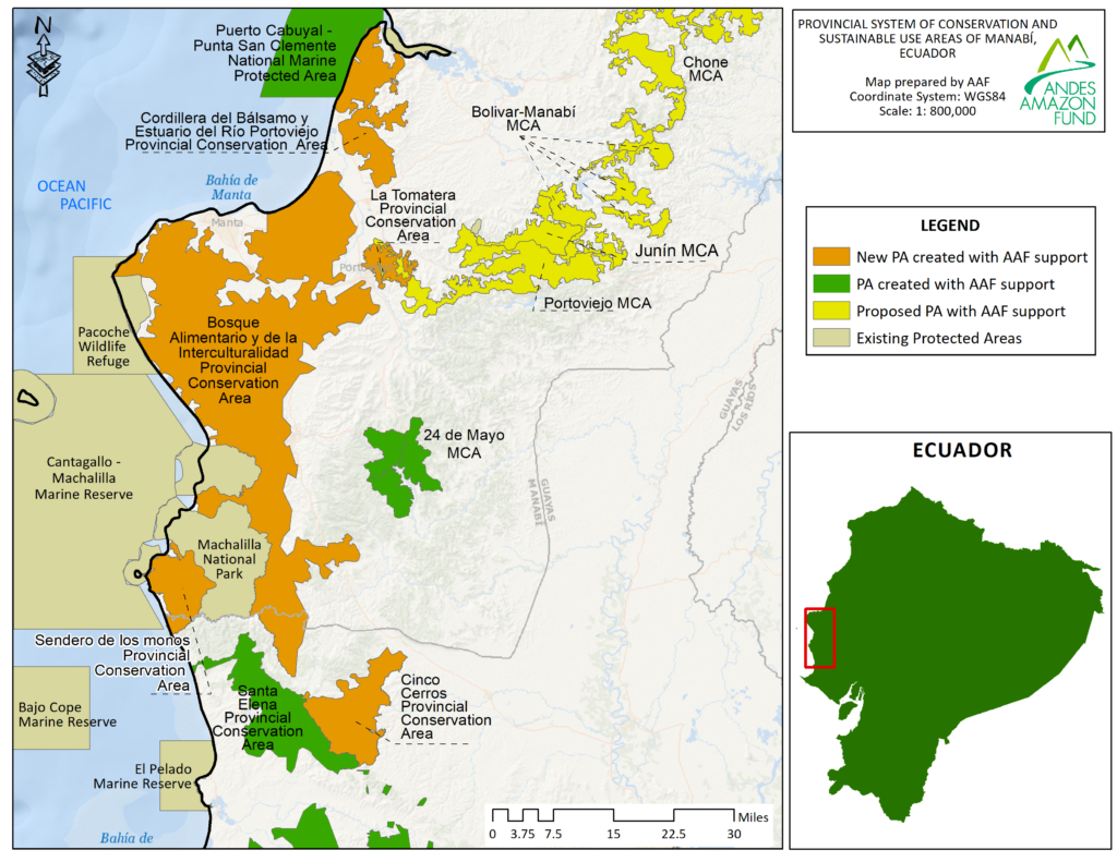
Andes Amazon Fund is thrilled to announce the creation of five new municipal conservation areas (a conservation titling figure termed in Spanish as area de conservacion y uso sustentable) in the coastal province of Manabí, Ecuador spanning a combined total of 596,589 acres (241,431 hectares). These five municipal conservation areas together make up the provincial system of conservation and sustainable use areas of Manabí. The newly established municipal conservation areas: Cordillera de Bálsamo, La Tomatera, Sendero de los Monos, Bosque Alimentario y de la Interculturalidad, and Cinco Cerros cover eight biodiverse ecosystems threatened by deforestation. We invite you to read more about each area below and to watch a documentary about the five municipal conservation areas at the following link.
Cordillera de Bálsamo y Estuario del Río Portoviejo
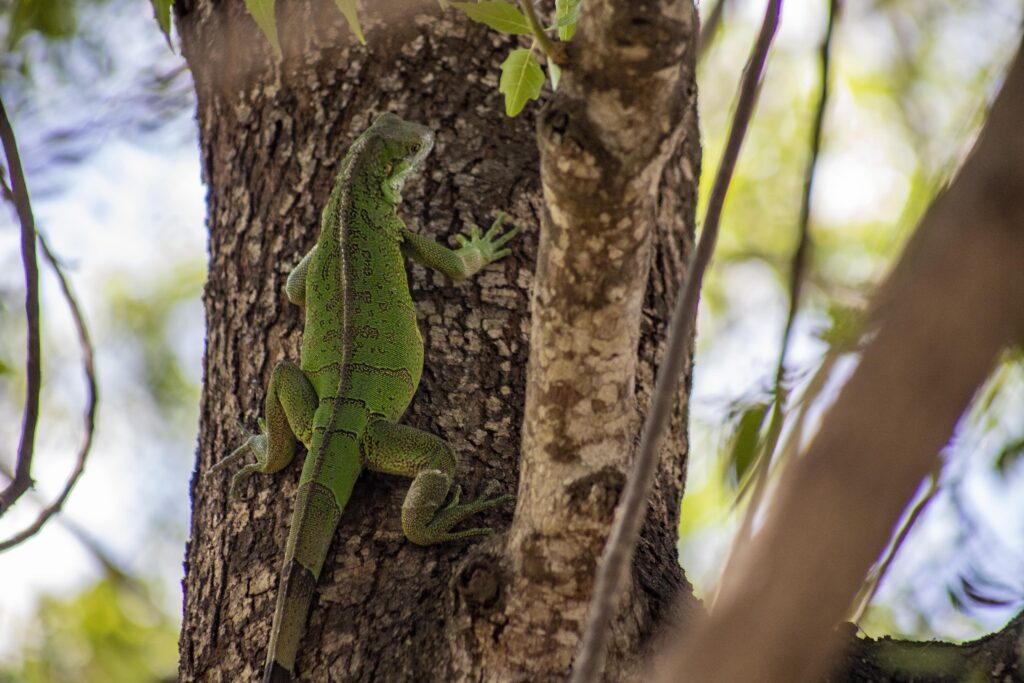
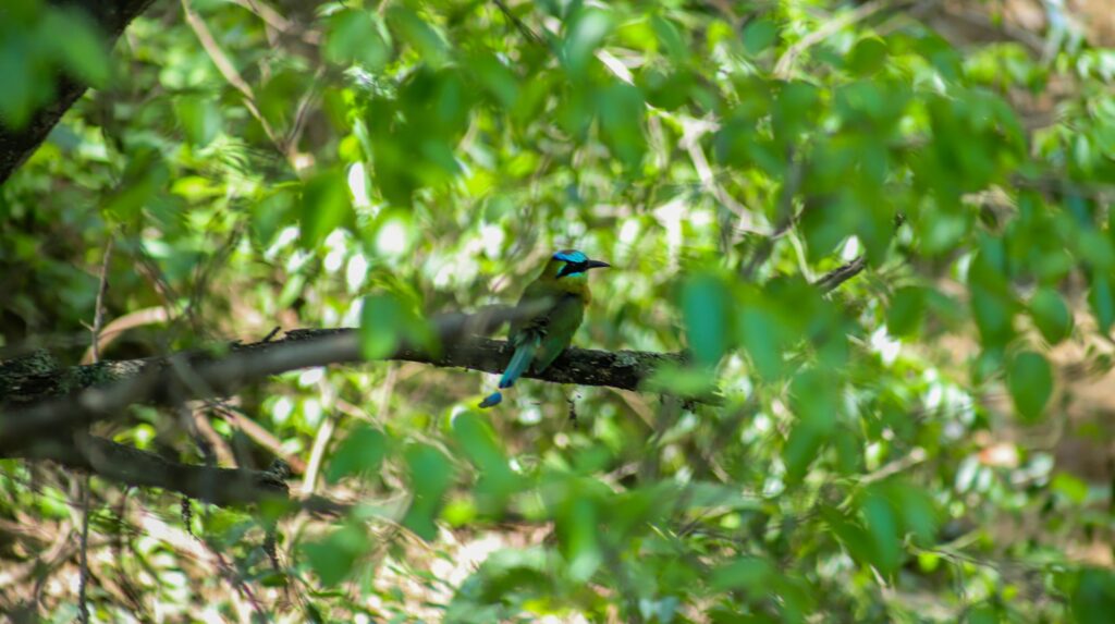
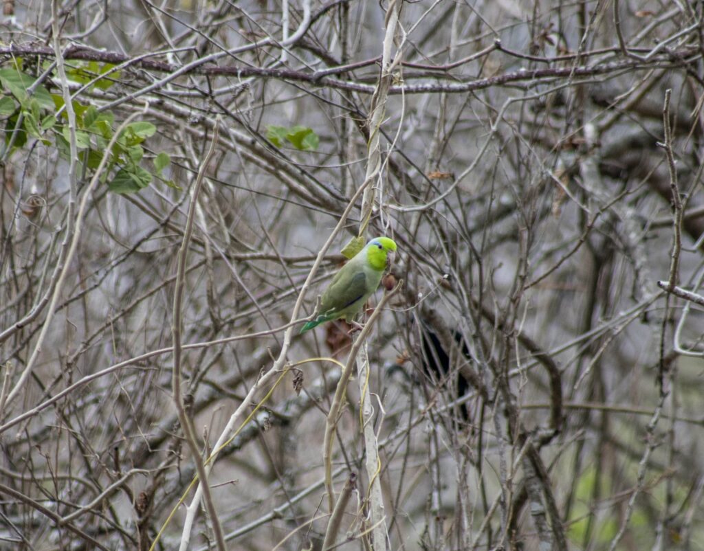
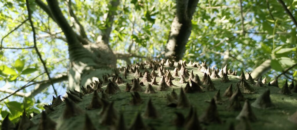
Cordillera del Bálsamo covers an area of 55,013 acres (22,263 hectares) of fragile ecosystems of the Jama-Zapotillo lowlands and the equatorial Pacific coastal range. The territory of the Cordillera de Balsamo municipal conservation area is recognized as a Key Biodiversity Area (KBA) and an Important Bird Area (IBA) with 459 species of terrestrial vertebrates, 300 of which are bird species. Among the 97 species of mammals within the area, nine are threatened species including the critically endangered equatorial capuchin monkey (Cebus albifrons aequatorialis). The area provides an essential habitat for a species of frog only present in Ecuador but globally extinct: the cap frog (Atelopus longirostris). This species remains critically endangered in Ecuador. In terms of plant species, the Guayacán (Tabebuia chrysantha), at risk of extinction, can also be found here.
Cordillera del Bálsamo y Estuario del Río Portoviejo connects with four additional areas within Ecuador’s National System of Protected Areas (called the “SNAP” in Spanish). They are: the Islas Corazón and Las Islas Fragatas Wildlife Refuges, the Puerto Cabuyal-Punta San Clemente Marine Reserve, and the Estuario del Río Portoviejo municipal conservation area.
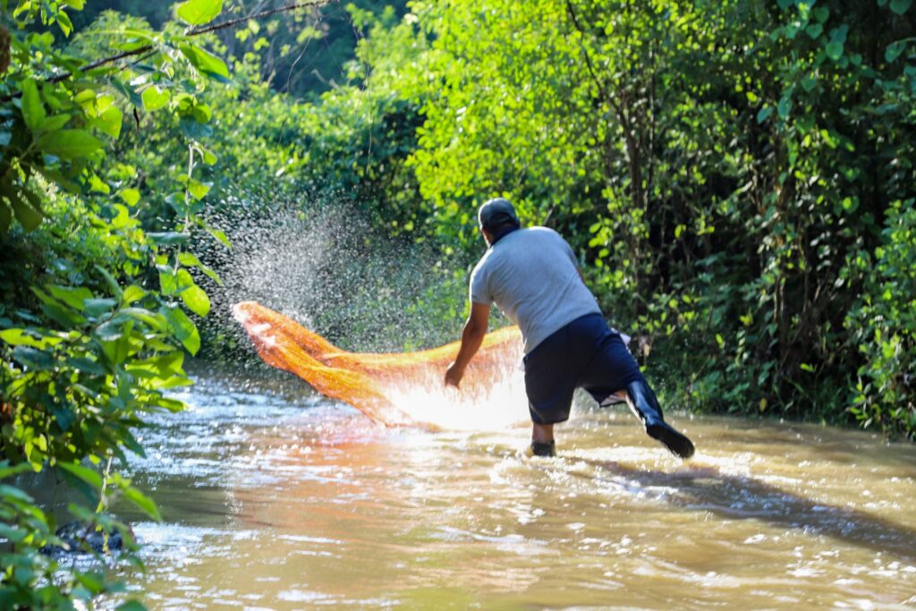
Approximately 3,722 people live within the area, bear a rich cultural heritage. Settlements of the Manteña, Pichota, Los Caras, and Japotó cultures are demonstrated in the Chirije Museum within the area. The communities are dedicated to creating handicrafts from local materials (toquilla straw, tagua, and wicker), ecotourism, agriculture, and various bioenterprises. Cordillera de Bálsamo y Estuario del Río Portoviejo has an altitudinal range of 7-490 meters above sea level.
La Tomatera
La Tomatera municipal conservation area protects 12,135 acres (4,911 hectares) of fragile and threatened low-land deciduous and semi-deciduous forest on the Ecuadorian coast. This area serves as an important ecological corridor, connecting the Bosque Alimentario y de la Interculturalidad with the Poza Honda. The protected corridor plays a crucial role in flood control for the populations of Portoviejo, Río Chico and Abdón Calderón, in addition to regulating the water systems of the Portoviejo River and Río Chico. The area also encourages outdoor recreation for nearby communities with a 32 km eco-route for cycling, running, and enjoying nature. To complement this, many families offer traditional regional cuisine for visitors to enjoy. La Tomatera has an altitudinal range of 34-390 meters above sea level.
Sendero de los Monos
Sendero de los Monos protects 32,816 acres (13,280 hectares) of seasonal evergreen, semi-deciduous, and deciduous forests within Puerto Lopez, Ecuador. This area creates a biological corridor between Machalilla National Park, the Cantagallo-Machalilla Marine Reserve, and the Santa Elena Provincial System of Conservation and Sustainable Use Areas. Not only is Sendero de los Monos a Key Biodiversity Area, but it is also crucial for flood control in three coastal towns and regulates the water systems of the Encantada, Blanco, and Ayampe Rivers. The area also has significant archeological and cultural value, with remains of five pre-Columbian sites present. The area hosts activities such as artisanal fishing, community tourism, and bird watching, among others. Sendero de los Monos has an altitudinal range of 0-587 meters above sea level.
Bosque Alimentario y de la Interculturalidad
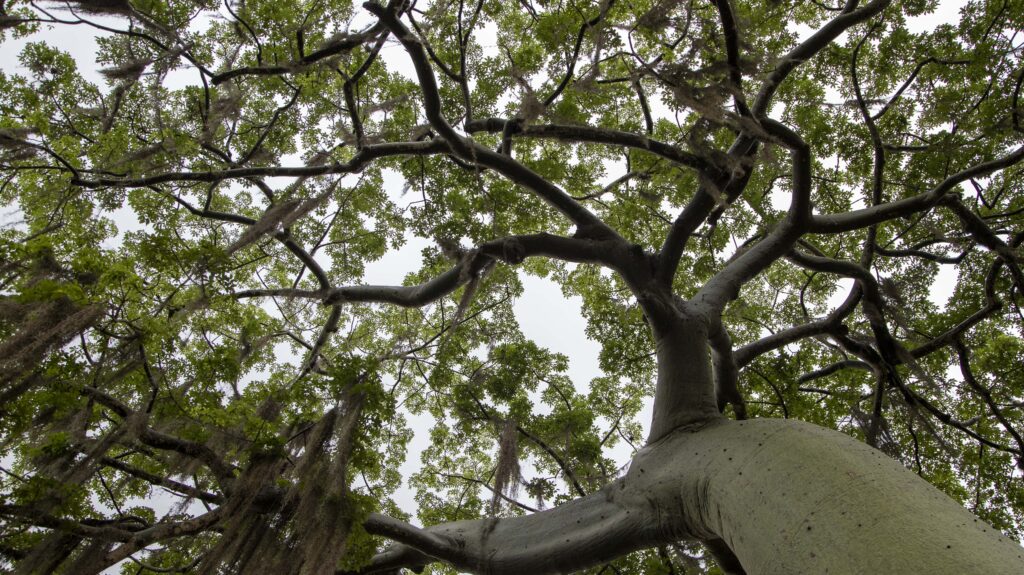
Bosque Alimentario y de la Interculturalidad safeguards eight different ecosystems and 512 species of mammals, reptiles, birds, and amphibians amid deciduous, semi-deciduous, and evergreen forests which together span 444,876 acres (180,035 hectares). With such high biodiversity, this municipal conservation area is a Key Biodiversity Area and part of an Important Bird Area. The municipal conservation area connects with the Pacoche Wildlife Refuge, the Cantagallo-Machalilla Marine Reserve, and the Machalilla National Park, as well as being linked to the Santa Elena Provincial System of Conservation and Sustainable Use Areas. The area is culturally significant as well, preserving the Cerro Hojas-Jaboncillo Archeological Complex and the ancestral fishing practices of the Liguiqui Commune. The communities living within the new conservation area generate a sustainable income through handicrafts, ecotourism, and sustainable production of food and forest products. Bosque Alimentario y de la Interculturalidad has an altitudinal range of 4-827 meters above sea level.
Cinco Cerros
Cinco Cerros safeguards 51,749 acres (20,942 hectares) at a slightly higher altitude than the previous areas (114-848 meters above sea level) and includes three types of seasonal evergreen forests: low montane, piedmont, and Jama-Zapotillo lowlands. In particular, this area has a high plant diversity with 283 species coupled with 440 species of mammals, reptiles, amphibians, and plants. The area is crucial for biological connectivity with the Santa Elena Provincial System of Conservation and Sustainable Use Areas and to control floods and provide water for the Guayas, Ayampe, and Javita Rivers and other watersheds. Communities within the conservation area rely on sustainable construction with guadua or bamboo, cane sugar production, ceibo tree wool production, and toquilla straw handicrafts, along with adventure tourism and bird watching.
Overall the five new municipal conservation areas will direct actions to protect and manage the biodiversity of the areas, aiding conservation and recovery efforts for these ecosystems and their environmental services, such as water provision. Sustainable management practices of the five new municipal conservation areas, such as with ecotourism, will help guarantee the protection of nature and the well-being of the local inhabitants.
Acknowledgements:
The establishment of the five municipal conservation areas in the province of Manabí was made possible by the provincial government of Manabí, in particular the prefect, Leonardo Orlando, the local governments that make up the Provincial Council of Manabí, who approved the ordinance that established the provincial system of conservation and sustainable use areas of Manabí and the municipalities that compose the five municipal conservation areas, which are: Sucre, Rocafuerte, Portoviejo, Manta, Montecristi, Jaramijó, Jipijapa, Puerto López y Paján. Additional contributions for the establishments are attributed to the governments of the parishes, communities, precincts and other social groups who welcomed the proposal. Technical support was provided by Paisajes Sostenibles (PASOS) and the Ceiba Foundation for Tropical conservation with financial support from the Andes Amazon Fund via the Wyss Foundation and Art Into Acres.
MAKE AN IMPACT
Learn how we can make an impact in our world together. Donate or get involved by subscribing to our email list: