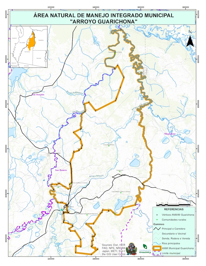
Andes Amazon Fund celebrates the creation of the Arroyo Guarichona Municipal Protected Area in the department of Beni, Bolivia. Home to floodplains, tributaries, expansive grasslands, vast forests, and evidence of pre-Columbian societies, Arroyo Guarichona safeguards both the cultural and ecological heritage of Northern Bolivia. The new area covers 492,815 acres (199,435 ha), and is home to Indigenous peoples, farmers, and local communities that pushed for the creation of the conservation area.
Protecting a Key Amazonian Floodplain
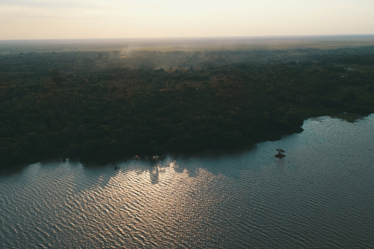
The new municipal protected area safeguards nearly half a million acres of the Beni plains, which are critical ecosystems for the overall health of the Amazon. Arroyo Guarichona, and its home municipality of San Ramón, compose part of the greater Llanos de Moxos ecoregion, considered the third most important floodplain system in South America. It is also the meeting point of four biogeographic regions: the Amazon, Cerrado, Chiquitania, and Chaco.
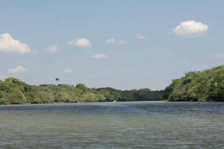
The floodplains within the Arroyo Guarichona Municipal Protected Area regulate and store fresh water, which is used for both human and wildlife consumption as well as recharging underground aquifers. The Mamoré River, which flows from south to north, joins with the Beni and Iténez rivers to form the Madeira River, one of the main tributaries of the Amazon. The municipality of San Ramón is located in the Itonama River sub-basin, influenced by the Mamoré sub-basin to the west and by the Iténez-Paragua sub-basin to the east.
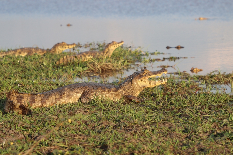
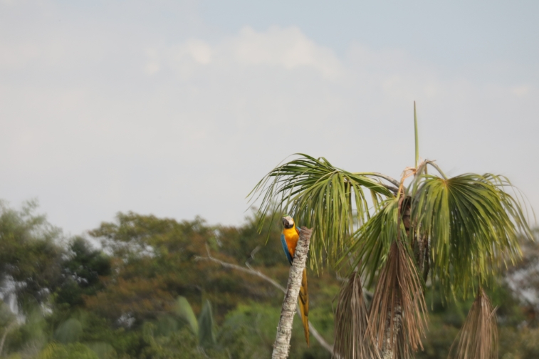
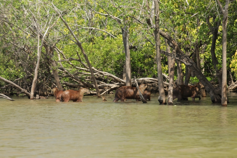
Due to its low elevation, the Beni plains experience annual flooding. This flooding allows for a high diversity of endemic flora and fauna, including the critically endangered blue throated macaw (Ara glaucogularis), the Yacare Caiman (Caiman yacare), and the endangered Rio Beni titi monkey (Callicebus modestus), among many other species.
The Beni plains also hold significant cultural and historical importance as they were home to numerous pre-Columbian societies. Many of these ancient civilizations mastered environmental engineering, creating intricate systems of dams, embankments, and levees to manipulate the flooding regime of the plains for agriculture. After 2,800 years, many of these impressive structures still stand, drawing interest from archaeologists and tourists from around the world. As the local government and communities develop management plans for the new protected area, they will leverage this ancient knowledge to guide their adaptation strategies.
Conservation from the Ground Up
The first stirrings of a potential conservation area in the region arose from local farmers, as they grew concerned about the indiscriminate fishing in the rivers and streams they relied on. Locals then signed up as “Volunteer Guardians” to enforce sustainable fishing practices in rivers like the Guarichona, which inspired the area’s name and the San Antonio del Poyori Indigenous community also proposed declaring the entire system of streams, lakes, and rivers as a protectedvarea.
In 2019, the Municipal Autonomous Government of San Ramón joined forces with the local communities, Indigenous peoples, rural farmers, and landowners to make this idea a reality. Then in collaboration with the NGO Conservación Amazónica – ACEAA they began the formal process of creating a Municipal Protected Area. These groups pledge to halt the extraction of aquatic species and the degradation of the area’s forests, floodplains, and soils. They also intend to stop the destruction of the Grande de San Ramón lagoon, which provides water for human use and consumption.
Highlighting the importance of the area, Conservation Amazónica – ACEAA said in a statement: “Declaring a territory as a ‘Conservation Area’ provides refuge for flora and fauna, allowing the movement of species and maintaining the balance of natural processes. In addition, it promotes policies for the protection, custody and promotion of the cultural and natural heritage of these spaces.”
Acknowledgements
The Arroyo Guarichona Municipal Protected Area was created thanks to the collaborative efforts of the Municipal Autonomous Government of San Ramón, local and Indigenous communities, volunteer professionals, and owners of rural farms (Mangal, Guacayane, Las Marías, Tacuaral and Entre Ríos as initial promoters of the initiative). Technical support was provided by Conservación Amazónica – ACEAA.
MAKE AN IMPACT
Learn how we can make an impact in our world together. Donate or get involved by subscribing to our email list: